Dead Reckoning (2014)
(with Aly Ogasian)
In navigation, dead reckoning (also ded [for deduced] reckoning or DR) is the process of calculating one's current position by using previously determined position, or fix, and advancing that position based upon known or estimated speeds over elapsed time and course.
As each estimate of position is relative to the previous one, errors are cumulative*, or compounding multiplicatively or exponentially, if that is the co-relationship of the quanta.
*"signal" refers to the wanted information; "noise" is something unintentionally added to the signal: "These unwanted additions may be distortions of sound (in telephony, for example) or static (in radio), or distortions in shape or shading of picture (television), or errors in transmission (telegraphy for facsilimile), etc." Both signal and noise are information. What determines which is which?
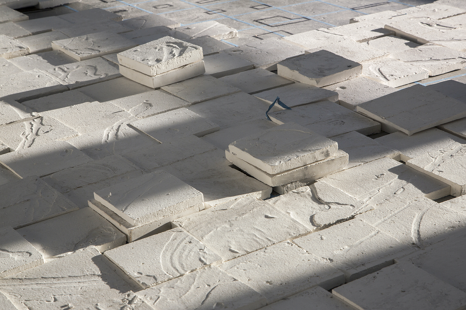
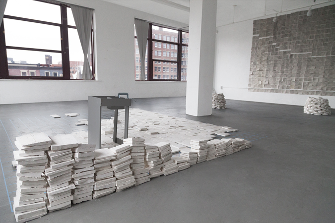
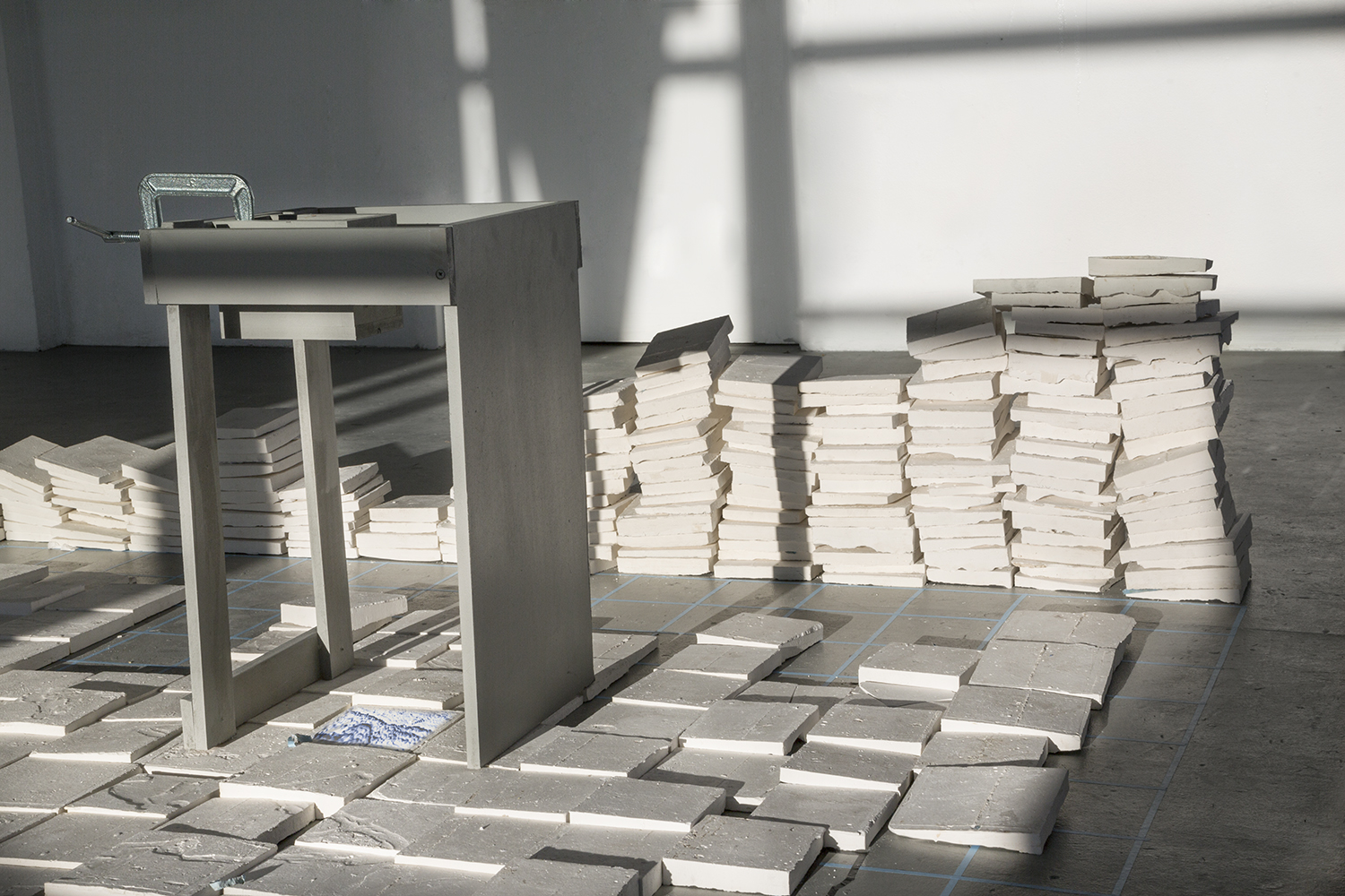
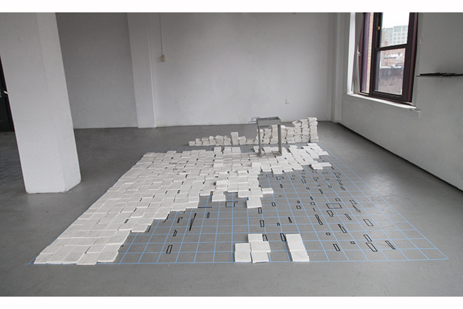
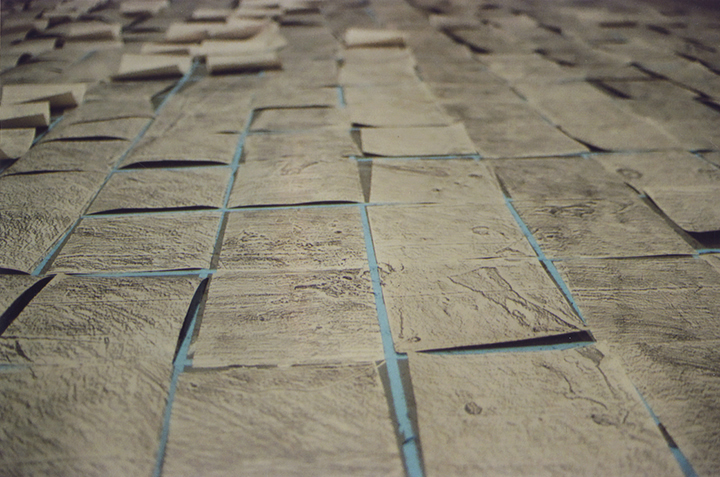
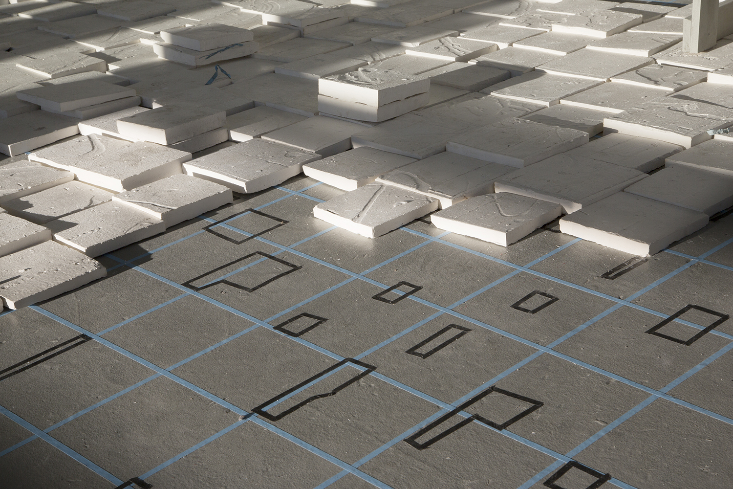
594 plaster casts of the studio floor
The installation overlays two locations that mirror each other through shifting scales and methods of documentation. Three overlaid maps of Northwest Passage as it was known in 1845, 1858, and 2014* are drawn onto the floor using a grid.
The second is the surface of artists’ workspace, where the floor is carefully gridded into 594 regions using the same system and is cast, scanned and reassembled. The cast regions of the studio floor are laid over corresponding mapped regions of the Arctic in 1845, large stacks signify represent unmapped regions, small stacks signify errors made in the casting process.
Wall: 594 graphite rubbings of the studio floor
Right floor: tape, 10' x 14' overlaid scale drawings of the Northwest Passage as it was known in 1845, 1858, and 2014, plaster cairn laid over the location corresponding to the last place Sir John Franklin was seen (containing video of Arctic ice with audio of graphite rubbing process), plaster cairn laid over the place where Franklin's last communication was found (containing video of plaster tiles with audio of Arctic ice)
Left floor: tape, 594 plaster casts of the studio floor laid over sections of the floor corresponding Arctic regions that were mapped in 1845, large stacks of tiles representing unmapped regions, small stacks of tiles representing errors made in the casting process, projector mount, video of 3D rendered tile corresponding to the place where Franklin was last seen
594 casts of the studio floor laid over corresponding mapped regions of the Arctic in 1845, video projection of 3D rendered tile corresponding to the last place that Sir John Franklin was seen
594 casts of the studio floor laid over corresponding mapped regions of the Arctic in 1845, video projection of 3D rendered tile corresponding to the last place that Sir John Franklin was seen

Plaster cast stone cairns, video + audio inside each cairn, 594 graphite rubbings of the studio floor, conte crayon, tape
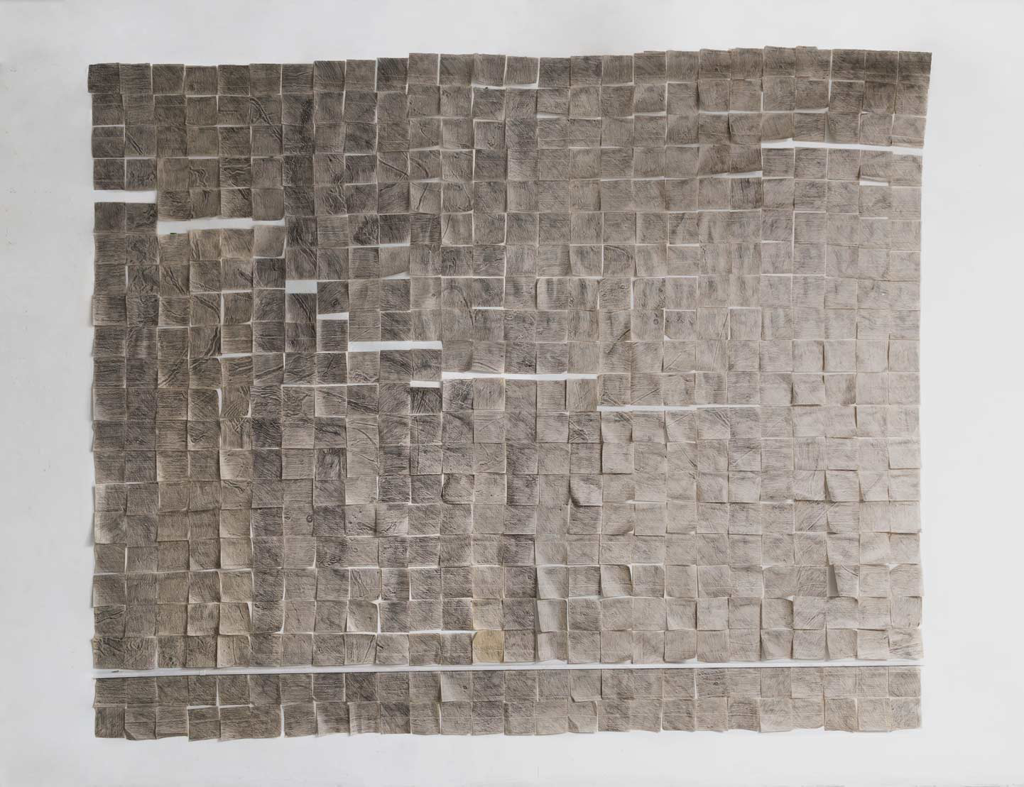
594 graphite rubbings of the studio floor
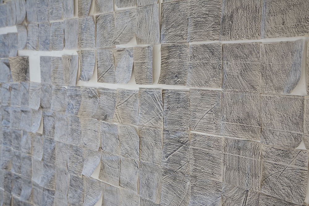
Graphite rubbings, Detail
Graphite rubbings, Detail
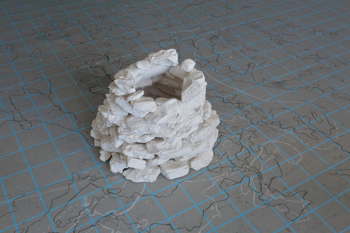
Scale graphite floor drawing of current map of Arctic region, scale gray conte crayon floor drawing of McClintock’s 1858 map of Arctic region, scale white conte crayon floor drawing of Franklin’s 1845 map of Arctic region, plaster cast stone cairn, video of plaster tiles, audio of Arctic landscape, tape
594 casts of the studio floor laid over corresponding mapped regions of the Arctic in 1845, video projection of 3D rendered tile corresponding to the last place that Sir John Franklin was seen

Photographic panorama of the original floor drawing in the studio, taken using projector mount used in final installation
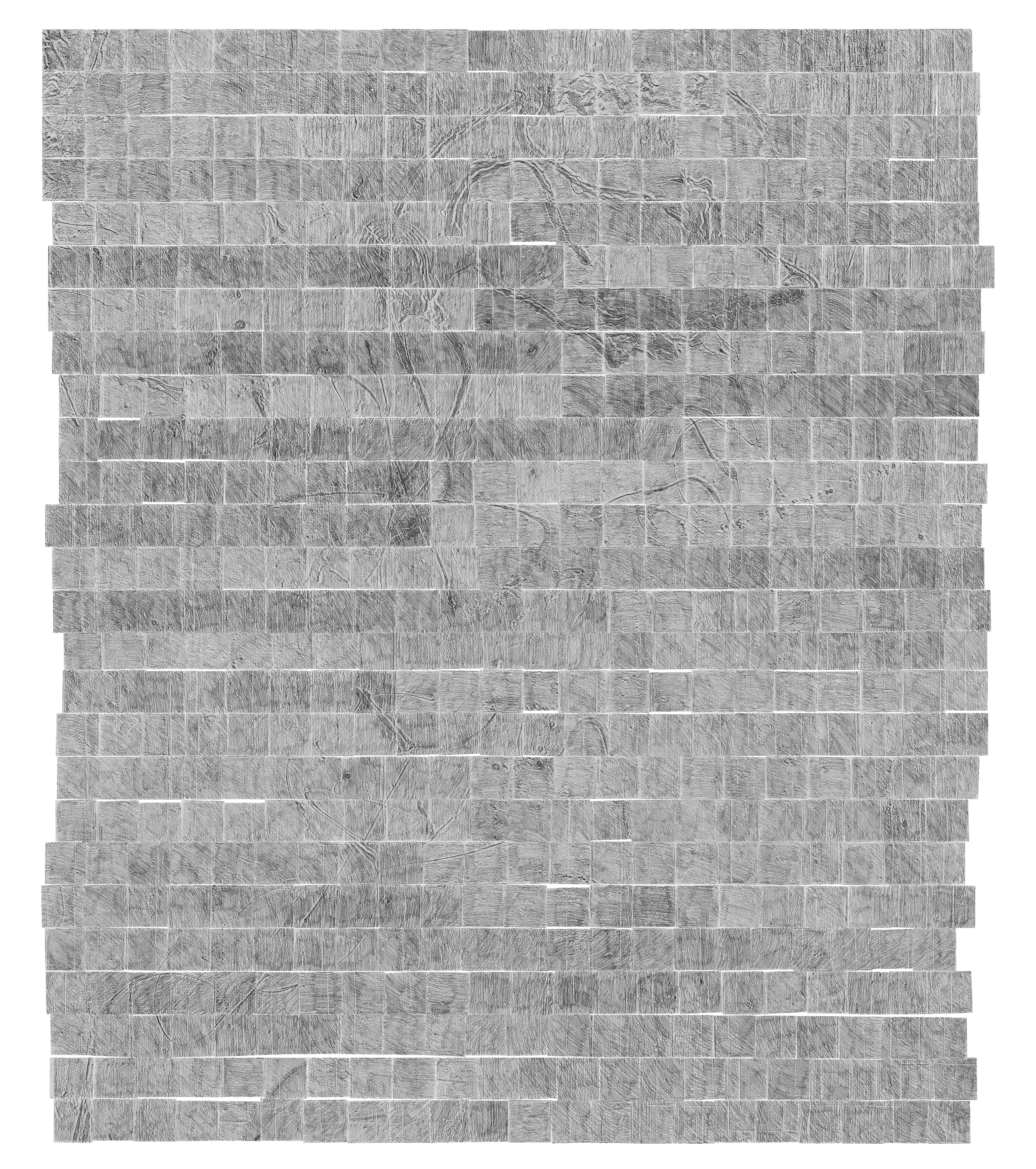
Digital Print: 594 graphite rubbings of the studio floor, scanned and reassembled digitally
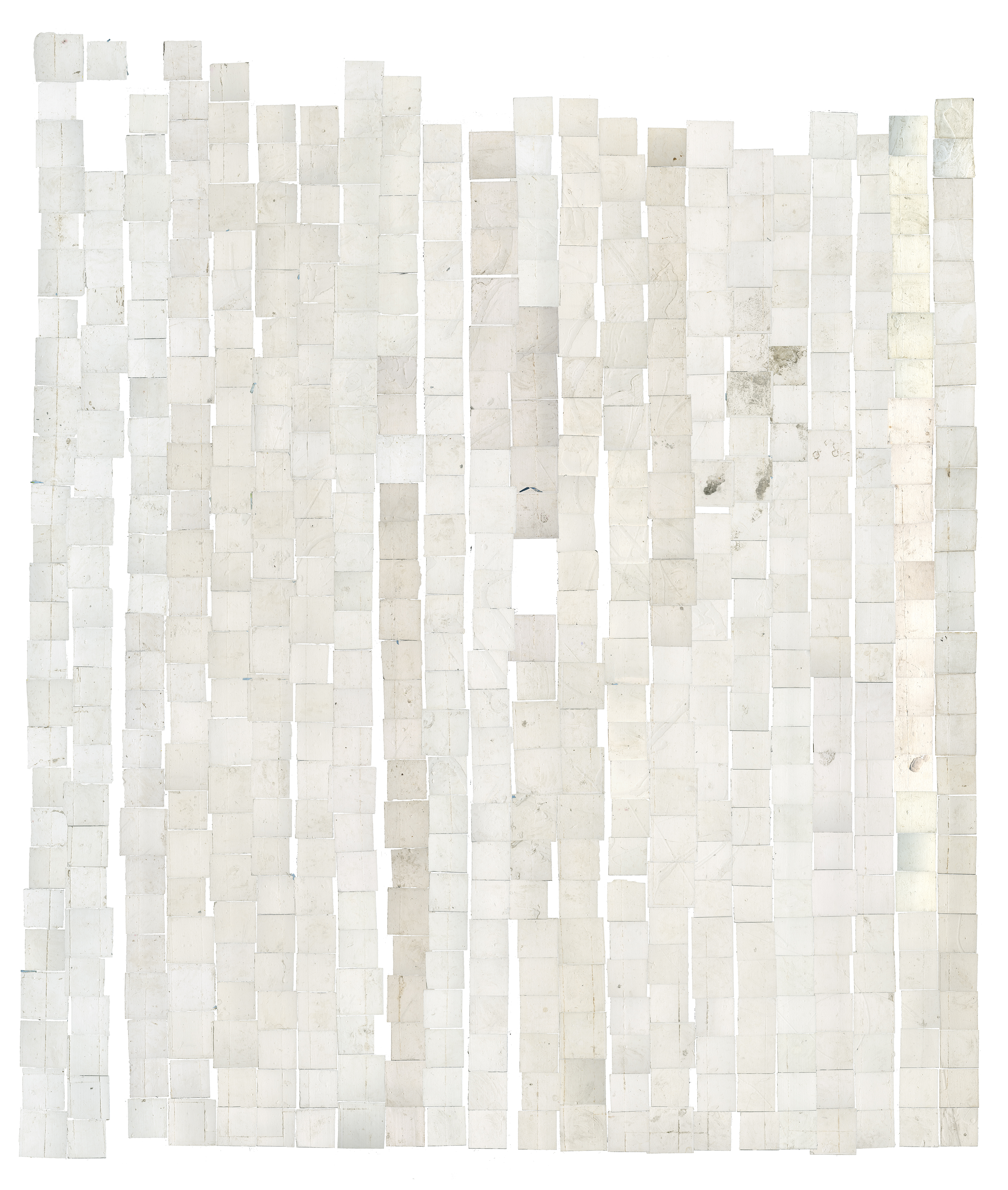
Digital Print: 594 plaster casts of the studio floor, scanned and reassembled digitally

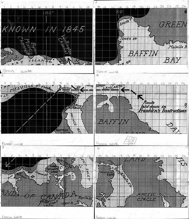
Map from 1845 used to generate scale floor drawing, grid representing actual, numerical system showing process
