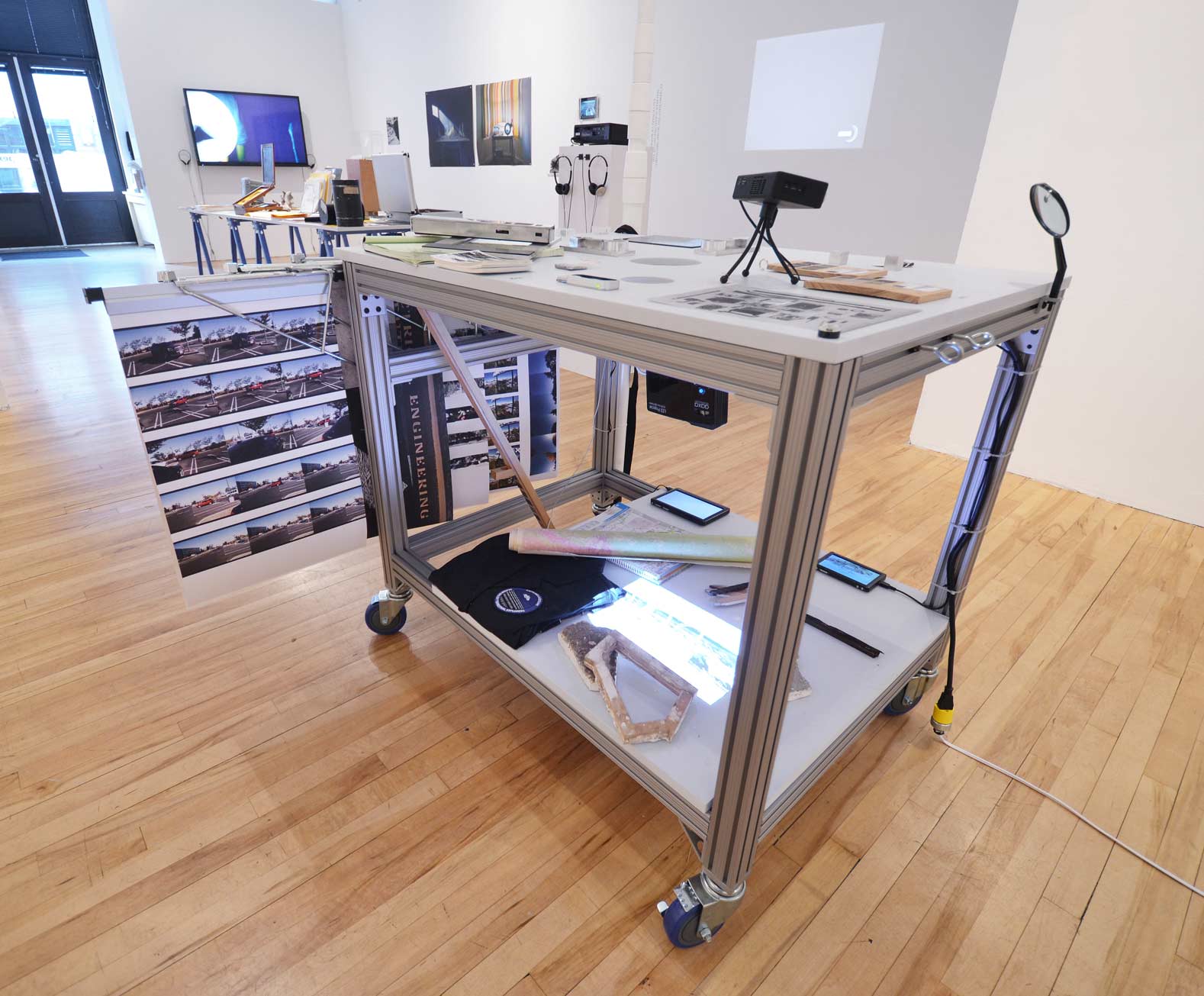
Captured Landscape (2015)
(with Stephen Cooke, Shona Kitchen, Aly Ogasian)

Focusing on historic and contemporary imaging technology, the collaborative project Captured Lanscape investigates how Silicon Valley has redefined the limits of "seeing" from the pioneering photographic work of Edward Muybridge to NASA's Airborne Sensor Facility.
Captured Landscape was produced by Stephen Cooke, Shona Kitchen, Alyson Ogasian and Claudia O’Steen with the help of Vivian Charlesworth, Yun Hong, and Tim Wang. Special thanks to Bruce Coffland and Josh Forgione of NASA Ames.


Silicon Valley Terrestrial Explorers' Expedition map sites from west to east: Sweeney Ridge (San Francisco Discovery Point), Crystal Dam, Sand Hill Road, Ampex Sign, Muybridge's experimental track, last camp of the Portola Expedition, Federal Telegraph Site, Fairchild Semiconductor Site, Google, Centrillion Biosciences, Lunar Orbiter Recovery Project (McMoon), Airborne Sensor Facility, Site of Onizuka Air Force Station, Santa Clara Station, The Lick Observatory/Mount Hamilton

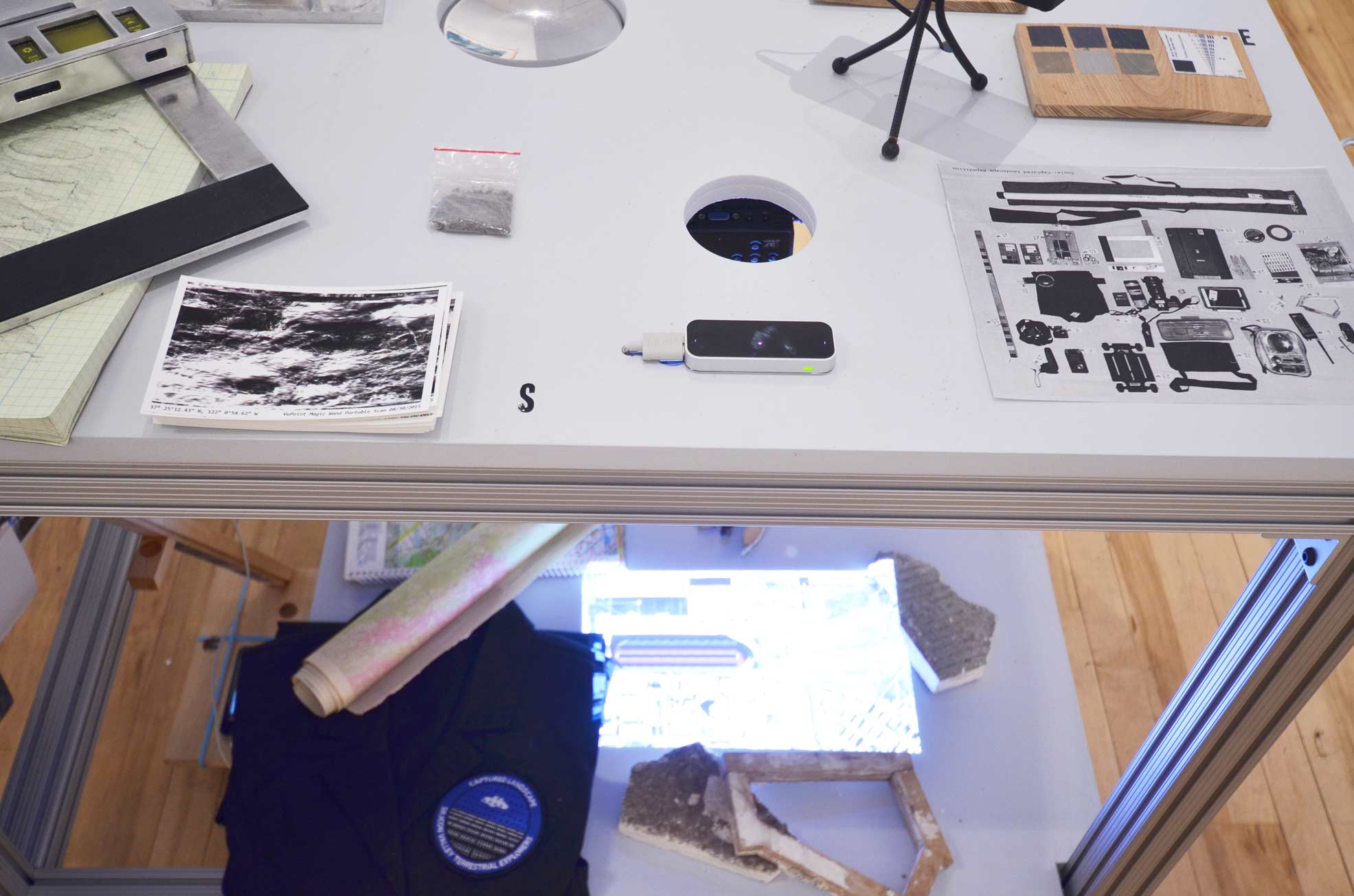
Documentation of tools used on expedition

37°36'42.0"N 122°27'19.3"W
Sky scan, enroute to San Francisco Bay Discovery Site. The Discovery Site marks the point at which the Portola Expedition crossed over Sweeney Ridge and saw San Francisco Bay for the first time, in 1769.
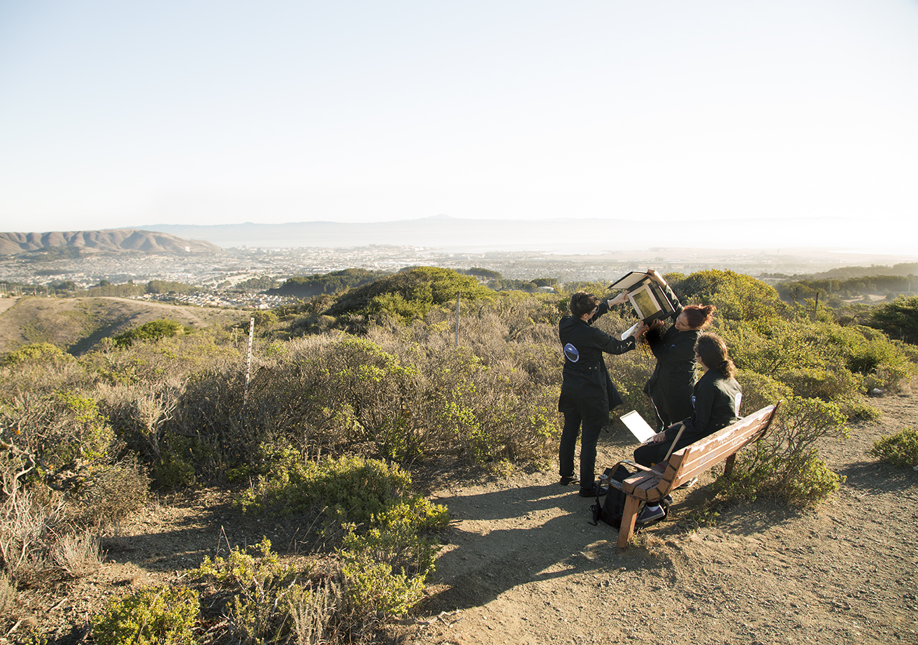
37°36'42.0"N 122°27'19.3"W
Sky scan, enroute to San Francisco Bay Discovery Site. The Discovery Site marks the point at which the Portola Expedition crossed over Sweeney Ridge and saw San Francisco Bay for the first time, in 1769.

37°36'42.0"N 122°27'19.3"W
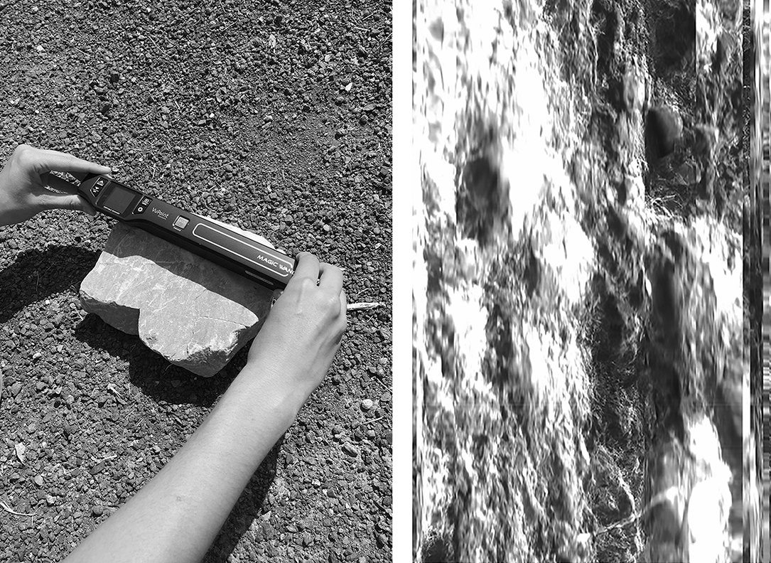
Surface scan of Serpentine rock marking the Discovery Site

Surface scan of Serpentine rock
37°36'42.0"N 122°27'19.3"W
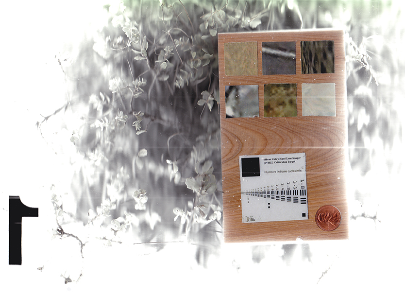
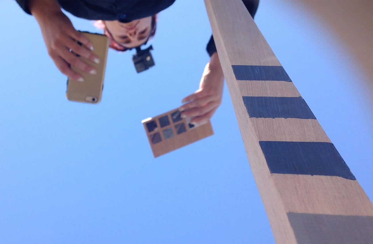
Surface scan of ground + Silicon Valley Hand Lens Imager (SVHDI). Patches of pigmented material on the upper portion of the SVHDI target serve as aids for interpreting color and brightness in images. There are six samples on each side, each one an image taken from Google Earth using the exact coordinates of each of the 12 expedition depots visited along the journey. The target's bar graphic is adapted from a standardized U.S. Air Force chart for testing camera resolution.
37°25'13.3"N 122°03'21.9"W
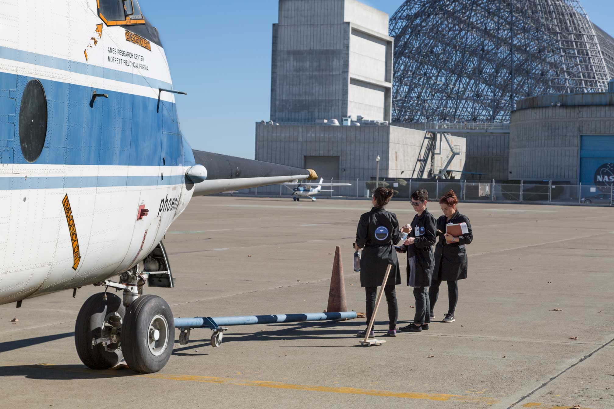
Runway survey at NASA Ames Moffett Field
37°25'13.3"N 122°03'21.9"W
Surface scan of Flight Support Facility N-211 at Nasa Ames Moffett Field

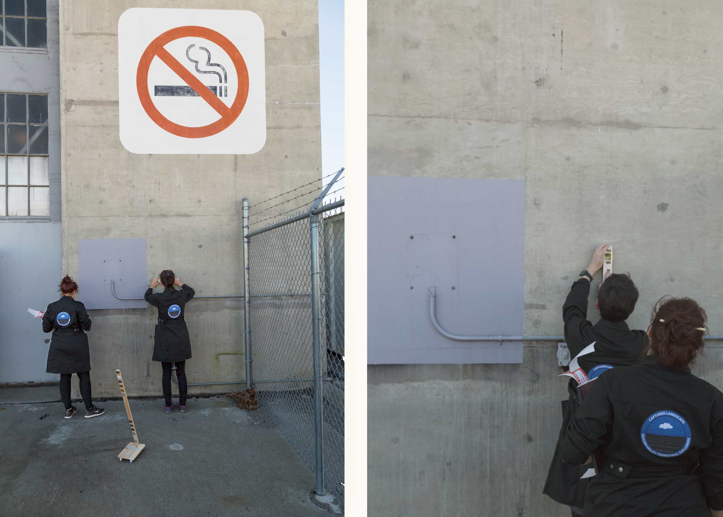
37°24'33.9"N 122°03'16.9"W
Satellite calibration test at Nasa Ames Hangar 1

37°24'33.9"N 122°03'16.9"W
Calibration image + surface sample taken at Lunar Orbiter Recovery Project

37°24'33.9"N 122°03'16.9"W
Calibration image taken at the Lunar Orbiter Recovery Project

Surface scan at Lunar Orbiter Recovery Project

37°21'10.7"N 121°56'11.0"W
Survey of Santa Clara Railroad Depot, the oldest operating railroad depot in California

37°21'10.7"N 121°56'11.0"W
Terrestrial scanning at Santa Clara Railroad Depot

Surface scan of Santa Clara Railroad Depot

37°29'17.1"N 122°12'15.3"W
Aerial survey of the Ampex sign (all that remains of the pioneers in analog audio + video recording)

37°24′27.35″N, 122°1′36.4″ W
Survey of Blue Cube at the former Onizuka Air Force Base, an ex-office of the National Reconnaissance Office
37°24′27.35″N, 122°1′36.4″ W
Survey of Blue Cube at the former Onizuka Air Force Base, an ex-office of the National Reconnaissance Office
37°25'11.9"N 122°03'54.3"W
Surface scan of Lunar Roverscape at Nasa Ames
